Sunday, February 26, 2006
Laughlin, NV to Lake Havasu City, AZ
Since the weekend was coming up, the cheap hotel rates in Laughlin were no more. They quadruple during that period. So we decided to vacate and look for cheaper lodgings, down south in Lake Havasu City, a town we already visited briefly on our first weekend here. After much searching and grumbling, we finally found a place close to the lake which was reasonably priced.
As always, the first thing we did after getting settled in is going to the tourist info for information on walks and such. They gave us a nice, 4 page leaflet describing walks on all sorts, lake shores walks, mountain walks etc. We chose the lakeshore walk first, because it seemed rather idyllic.
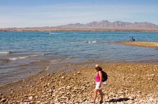
The first 500 metres were. Unfortunately, after that, we ended up on a rocky, slimy shore and the only way around it was through unknown thickets, through which over time a path had been created by living things unknown.
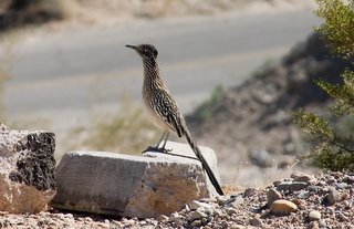
Now, I realize I had never heard of the presence of alligators and crocks in this part of the US, but hey, there's water, sort of swampy in some places, brush, and warmth and I can put 2 and 2 together about as well as anybody. Seems like the right combination to me, so the only gallant thing to do was to let Anne lead, since, if one of those guys were to grab her by the leg, somebody would have to save the damsel in distress by running for help. Anyway, except for a roadrunner and a rabbit, no dangerous wildlife was spotted.
Lake Havasu was formed when Parker Dam, downriver about 30 km was formed I believe in 1938. The city itself got its start in 1962 and has grown to about 55,000 inhabitants according to the 2001 census. However, around 20,000 or so snowbirds move in in the wintertime.
Now, Lake Havasu City is not without problems. One of the main problems is an imbalance. An imbalance between the amount of money people have and the braincells required to do something intelligent with that money. We were appalled by the number of monster speed boats on the lake, and I mean monstrous, 30, 40, 50 feet. These emit a low grumble when idling which is audible all day long when you are anywhere on the lake shore, especially when it is multiplied by a factor of 100.
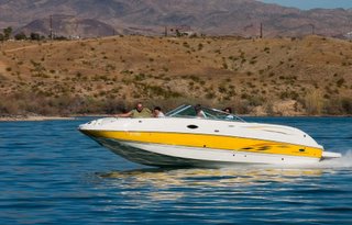
Of course along with the boat goes a trailer and an equally monstrous pickup truck, some of which seemed to be custom built, as I ain't never seen that kind of truck before. Everything is gleaming to boot. So you're likely looking at a million dollars just to get you're boat in the water. You'd probably need a fuel tanker to follow you around to keep your tank somewhat filled up.
The next morning, Saturday, we decided to get away from the lake and go on a mountain walk, which again we chose from the leaflet given to us by the tourist info. Heading away from the city, we reached the end of a paved road and followed the dirt portion up another 2 km or so till we parked at the spot indicated on the leaflet.
We got out and started to walk towards the mountains following the dirt road, but it really wasn't all that interesting, it looked like a huge gravel pit. And what do yahoos like to do in gravel pits? Right, shoot target practice that is. And so it was here. No sooner had we gone up this little hill to get a better view of the city below or this convoy of jeeps pulls up below us, guys jump out carrying rifle cases, from which they (surprisingly) take their rifles and start to load up.
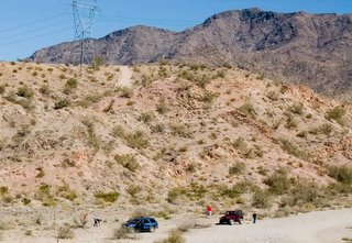
That was enough for us. We headed straight back out. While making our way back to the car, the gun fire started in earnest and it felt like Iraq (or Detroit) for a while. When we got to our car, some other yahoos were firing upon an abandoned car wreck not too far away with a semi-automatic. While driving out along the dirt road we saw a father training his 8 or so year old son in the use of a gun. I sure was hoping the kid wouldn't swing his gun around in our direction and accidentally fire.
So much for that walk.
We finally found a State Park, that had a decent walk. Half way we stopped for a Corona, had a boat ride, then walked back. That was a lot better.
Dinner was had at a noisy Mexican Restaurant, Casa Serrano, though the food was delicious and the prices were reasonable.
Tomorrow we're off the Laughlin again, where I've been able to snag a hotel room at the River Palms for $ 20. And that's Canadian.
Saturday, February 25, 2006
Grand Canyon, AZ to Laughlin, NV via Kingman, AZ
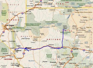
We decided, for no good reason, to make Kingman, AZ our next stop. Well, may be there was a reason, a bit of one, we wanted some warmer weather, and in this part of the world that means lower elevations. The South Rim of the Grand Canyon is at about 2100 m, Kingman is at 700 m. That translates in a significant temperature difference. So we drove to Kingman, via Williams, about a 3 hour drive.
Now, Kingman is not exactly a beautiful city, in fact quite the opposite. It is a perfect example of urban spread gone bad. First the town developed on an east-west axis, along Route 66. When I-40 bypassed the town and Route 66 fell in disuse, many of the buildings along that section were abandoned. A new development axis, along a north-south line, started to take shape. Big box stores of every imaginable franchise moved in. Now, rampant development involving big box stores seldom results in a good example of city architecture: that is especially true here. So here we found ourselves, in a motel along a busy highway, which was under construction to boot. Anyway, we had dinner in a simple, but nice Mexican restaurant and turned in early.
Next morning, not exactly looking forward to another nite in Kingman, I looked on the map to see what other towns, places were available. So I spy with my little eye Laughlin, Nevada, just across the Colorado River from Bullhead City, AZ, a mere 40 km from Kingman. I did a search in Expedia and found a whole series of hotel rooms at fire sales prices. Turns out Laughlin is a mini Las Vegas, seemingly used by mostly senior citizens, with big hotels and a casino strip. So, at $30 (Canadian) I decided to book a couple of nights.
Close to Kingman is a mountain range, the Hualapai Mountains, and tourist info in Kingman had given us a nice map showing a hike in the County Park. We drove the 20 km or so and parked our car, where we had a nice chat with a couple from Buffalo (did anybody in this country vote for Bush? We haven't found one yet.)
After some searching, we found the trail head, and started our 2 hour, beautiful, uneventful walk. On the way up, we spotted some cabins that you can rent, we might check that out next time, they looked really good.
Then we drove back to Kingman for our trip over to Lauglin. From Kingman you first head over a low mountain range heading west, then into the Dome Valley, about 20 km, before you get to another low maintain range, the Black Mountains. One you reach the summit there, you start a very, very,very long descent at 6% for 18 km to the Colorado River level, about 1 km lower. Off to the right you see "Runaway Truck Ramps", so I kept checking my rearview mirror to see if we were about to be crushed, because after all, you want to know in what fashion you are about to die. Seeing no trucks barrelling down on me, we coasted to a stop at the traffic lights on the bottom of the slope, before we made the turn to cross the bridge to Laughlin, NV.
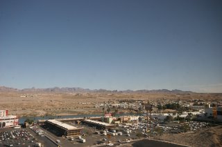
Driving into Laughlin provides quite a few stunning sights, with numerous hotels 25 stories high, garish neon signs everywhere beckoning gamblers to come and harvest riches. We registered ourselves in our hotel, the Ramada Express and went for a walk, exploring the riverside, because, after all, we just came from a mountain hike, so what's another 3 or 4 km over hot pavement?
Anyway, the riverside walk is very nice, the Colorado flows very fast at this point, almost rapids. It is also very clean, we saw very large fish, eyeing little kids on the river bank, so that must be a good sign. More importantly, we spotted a happy hour sign, which we could not pass up, so we imbibed, but only in moderation. Now, I'm not much of a gambler, but I got myself signed up anyway at the Hotel Frequent Player's Club, since that gives you discount on food, and why not, like my Dad used to say, a dollar in my pocket looks a heck of a lot better than a dollar in their pocket (actually he used guilders, but you catch my drift). Since it is my duty (and everyone else's as well) to rip off large corporations, I felt very good performing this public service.
We then had a wonderful buffet, watched the Canadian women beat the world in the 3000 m (NBC had no American heroes that night, so English speaking Canadians were a wonderful substitution), and called it quits, i.e. went to bed.
Next morning, we put the frequent player's card to the test again and had a nice breakfast, mostly at hotel expense. We booked a 'cruise' on a river sight seeing tour, where the captain or somebody up front-because-we-never-did-see-him did a very good narration, about how Laughlin was formed. Laughlin's only about 40 years old, started basically after the completion of Davis dam, a little brother to Hoover dam on the Colorado River. Before all the dams were constructed on the Colorado, the river was a shade of reddish brown, because of all the sediments it carried. Something I never knew was that Baja California is a basically a giant sand spit created by the runoff from the Colorado River. So if you want to know what happened to all the material that was carried out of the Grand Canyon, look to Mexico, to Baja California, where is was all dumped. May be the Americans will reclaim it one day and make another state out of it. After all, it is their material. After Iraq, anything is possible.
Nowadays, none of the Colorado River water makes it down to the Sea of Cortez: it is all consumed by thirsty Los Angeles, Phoenix, Tucson, and giant irrigation schemes around Yuma. What little is left at that point is usurped by the Mexicans for drinking water and other purposes.
Depressing enough at that sounded, we just had to have a picker upper, which of course can only be provided in either alcoholic fashion or seeing the Canadians beat the Russians in ice hockey. Yeah, I won't go there.
So now we are completely in the dumps. That is, until my favorite person (Anne) invites me to dine with her in the most expensive restaurant in the Casino. No stuff-your-face-buffet for a change, real waiters carrying fancy bottles of wine, not that that means anything to me, but hey, I can pretend, can't I?
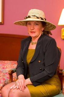
Before we went downstairs to the restaurant, I shot her official portrait. Actually, I was playing around with lighting (some call it lightning), and this is the only one (of the 40 odd shots) that came out half decent. But then, with digital, you can do this.
Dinner was wonderful, but oh my God, the portions were so big. I had a 12 ounce New York Strip Sirloin, the size of Manhattan. My baked potato was the size of Prince Edward Island, to say nothing of the vegetables and salad. The wine was Kenwood Jack London from California. Here I thought all a Kenwood was good for was haulin' logs.
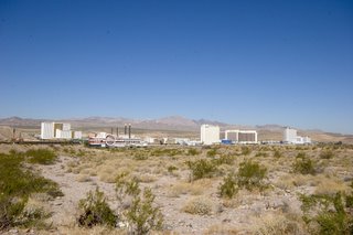
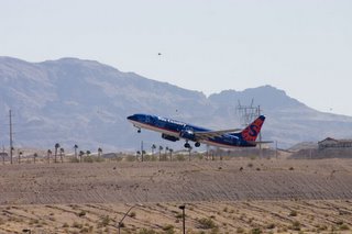
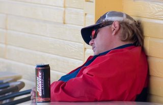
We had a wonderful view of the planes taking off on the airport, just across the river. The Arizona side is at that point almost completely devoid of any development, save for a Home Depot franchise, and a Mr. Lube. On the Nevada side, now that's where things are happening. Well, at least for some, because you can clearly see that one gambler/drinker/cigarette smoker had one too many "High Gravity" lagers.
Finally, some may remember 'Vegas Vic'. Well, he was transported down to Laughlin on renamed 'River Rick'.
Here's today's KML
Tuesday, February 21, 2006
Kayenta, AZ to Grand Canyon, AZ
We got up in the morning only to find that it was snowing! Now, I wouldn't call this a Great Lakes type snowstorm: a light dusting is all that it was. As soon as the clouds parted and the sun came up, it started to melt. We had our breakfast and headed out, straight for the Grand Canyon, about a 300 km trip. At first I paid close attention to the road, you never know there could be black ice on stretches sheltered from sunlight. None materialized, so I picked up speed. After an uneventful drive, we reached the outer limits of the Grand Canyon National Park. In winter, you can only go to the south rim, as the north rim is closed due to snow.
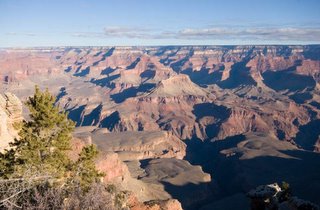
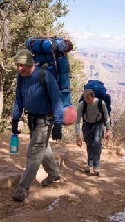
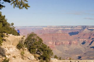
Since we had some lingering low hanging cloud from the overnight snowflurries, the north rim was hidden beyond cloud. That didn't last too long though, soon the entire canyon was revealed in its splendour. The crowd at this point, the most easterly viewpoint called Desert View, was minimal, just a few cars. Just the way we like it. There are numerous view points along the rim from there to Grand Canyon Village, about a 40 km drive. At about the second viewpoint we read a sign that said "Grandview Trail". Reading further we learned that this was one of the trails that can take you right down to the river, 1500 m below the rim. (FYI, the south rim is about 2,250 m above sea level, the north rim is another 300 m higher. It's about 20 km across). Anyway, a couple of hikers just happened to reach the top as we stood there. I took their picture and you should be able to discern by the looks on their faces how exhausted they were. Emaciated might be a better term. They had been on their way, climbing steadily, for almost 6 hours, with heavy backpacks.
We moved west and the further we went, the thicker the crowds became. And this in February! It got so bad, that in the main parking lot there wasn't a spot to be had. This sort of put a damper on things, as we're used to being alone just about everywhere we go. Not only that, the crowds are noisy and boorish. We saw a family where Dad positioned the kids precariously on a set of rocks right above the rim (100 m drop immediately behind), while Mom up top shot a picture. So, all in all, it was a bit disappointing and we decided to retire early to our the Quality Inn in Tusayan, about 10 km south of the rim. (You can actually stay in National Park Service lodges right in the park, but I was too late, they were all filled up).
Feeling somewhat depressed after such a tough day (tongue firmly in cheek here), we chose to attend the local IMAX theatre, where, surprise, they showed a movie about the Grand Canyon. Wow, even tough it's over 20 years old, it still looks pretty good. We stuffed our faces at the buffet dinner at our hotel and since we wanted to be up early to avoid the crowds during the rim hike, we retired early.
Cold and clear was the weather when we got up. Again, the 4 litre bottle of water was frozen solid. Every time we want to use it, it's frozen solid. We picked up some much needed groceries at the very expensive food mart across the road and hopped in the car for the very short drive to the rim.
Our luck was turning. Instead of human wildlife of the worst kind, we saw animal wildlife of the best kind. Just before we reached the rim, a couple of deer, calm as ever, wanted to cross the road. Ever the gentleman, I let them go ahead.
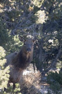
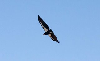
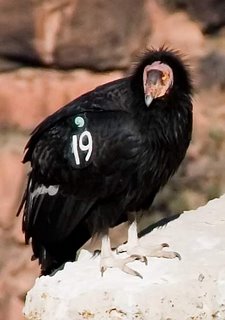
We started off on the rim walk, which you can make as long as you want: if you feel you're sick of it, just turn around and walk back. For most people, this point is reached after about 30 seconds. Us, well we thend to hang in a little longer. We barely got under way when we spotted some elk! I banged off a couple of shots. and we moved on. What would be next? We headed further east, meeting the occasional hiker or hikers, until we reached Grand Canyon Village, where we succumbed to the need for a coffee. We acted snooty, standing by the fire place in one of the most expensive lodges, before reality set in and we went back on our way. At the village, there is another trail that descends, the Bright Angel Trail. Just to say we had been below the rim, we descended a few steps, but came back up. We began our return trip on the rim. Just then, we spotted some condors, so I took a few more shots, one of them of an airborne condor, the other where the birds are resting on a rock. These birds have been marked with giant numbers on their wings, sort of like soccer players, maybe they were in the middle of their game and this was their tea break.
Some parting shots, literally of the Grand Canyon. You're a big hole. It's been good to know ya.
Monday, February 20, 2006
Kayenta, AZ to Kayenta, AZ
If the title of this post sounds a bit like a stage in the Tour de France, then please accept my sincere apologies. I really don't know how else to describe the loop which brought us from Kayenta to Kayenta. We start out fairly early on Sunday morning, after continental breakfast and head north on Highway 163 towards Monument Valley again. The snow I hoped for didn't materialize: unfortunately, because that would have added an extra special touch to my pictures. At least there are lots of puffy clouds in the sky. As I said in yesterday's post, we had decided to do the 5 km walk in Monument Valley today.
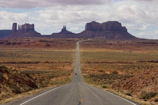
On the way to Monument Valley, quite close to Kayenta actually, you get to a hill in the highway. Once you crest that hill, you get to see the most amazing sight. On the right, there rises the solidified core of a former volcano ('El Capitan') to a height of almost 300 m above the surrounding plain. The core is the only thing remaining of El Capitan, the rest has eroded away over time. On the left, the remnants of a former butte rise up, looking very much like a statue. But what statue? From various angles it always looks like a different statue. In the middle, there is the lonely highway. Before you ask, no, I'm not scared of standing in the middle of a highway taking a picture. The reason why is simple: you can hear traffic approaching from a long way away.
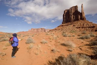
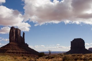
We reach Monument Valley, pay our $10 entrance fee again, that gets me sort of bummed. However, it is still a bargain for the sights you get to see. We sign in at the visitor's centre, supposedly you have to do this before you leave and sign in again after you return. I see that for this year there were only 30 or so entries in the book. We head out, on top was windy and cold, hats, gloves, winter coats are definitely required. Once we get going though, we warm up quite nicely, aided by the fact that the valley floor is well sheltered from the prevailing westerly wind.
At the outset, a sign tells you what not to do and what to look out for. Don't stray from the trail and do look out for venemous reptiles and insects. I presume they mean snakes and scorpions, but I'm sure these critters won't be out in the cold weather we are facing. The trail itself is moderate to easy and well marked, so getting lost is definitely difficult. The 5 km trail leads around one of the main buttes, called 'West Mitten Butte'. Since nothing but the birds and the wind, as well as the occasional click of the camera shutter may be heard, it makes this extra special to be there next to these giants who seem to take on human qualities with their shapes and sizes. The views again are spectacular and it seems like the trail's end arrives sooner than anticipated. We meet no one. I sign out and we leave Monument Valley for other visitors to enjoy.
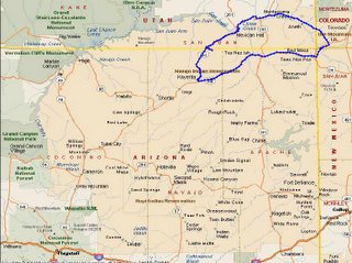
Having still most of the day ahead of us, we decide to follow Hwy 163 north into Utah, then go east on 162 into Colorado and then take 160 back again to Kayenta for a circle tour. Just north of the Arizona border, in Utah, the views are quite spectacular, especially that of Monument Pass looking back towards Arizona.
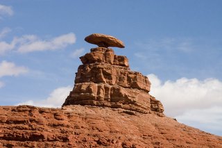
However, the rest of the scenery in Utah is awesome as well. One can only wonder what shapes of nature created the landscape, but one thing's for sure: the area was a cauldron at one time. When we cross the San Juan River, we come to a place called Mexican Hat and I wonder where did they get that name. Well, it isn't very long before I come around a bend in the road and see this. Puzzle solved. I find a spot in sight of the Mexican Hat, we eat our lunch there, hmm, cucumber sandwiches. After lunch, I decide I must get a shot of the Hat, so I walk across the desert for half a kilometre in order to clear some hydro lines. Take the shot, then walk back again. We drive off, only to clear the next hill and see a driveway right up to the flaming rock. Let me tell you, folks, it doesn't pay to be brainless. On we drive, more spectacular Utahian (sp?) scenery. We try to make it into the Valley of the Gods, but the smallest of creeks flows across the mud access road and I chicken out. Stopped by water. In the desert. Hoodathunk. The terrain gets even wilder with red colors, striations going every which way, then levels off somewhat as we head for the Colorado border. There, we 'hang' a right onto Hwy 160, and proceed on to the Four Corners.
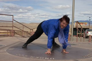
Four Corners is the only place in the US where 4 states meet. At the exact spot is a monument placed by surveyors. The place is wholly contained in Indian Country: The Ute Nation in Colorado, the Navajo in Arizona, New Mexico and Utah. You pay $ 3.00 entrance fee to get near the place and for that you acquire the privilige of visiting hundreds of stalls selling jewelry, blankets and the like.Sort of like Costco, only out of doors. We instead have some Navajo Fry Bread, which tasted yummy, but don't ask me what was in it, flour I presume.
Next of course comes the customary and obligatory photographs. And, by the way, who sez a woman can't be in one place at the same time? I've got the pictures to prove differently: Anne equally divided in four states. I wonder which Sheriff would have to 'bring her in' if they hear the profanities she offers while I take her picture.
By the way, I placed my logger directly on the Monument, and, according to the way I see it, it is in the wrong spot by at least a couple of metres. Pity the poor surveyors who a hundred or more years ago had to run line to get to this point, far away from home and only marginally closer to the nearest saloon.
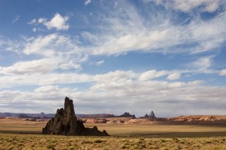
We continue our way, now westbound, to Kayenta. Fairly close to Kayenta, I stop for yet another exposed volcano core (there are actually quite a few in this area). Church Rock, it is called. Appropriately enough, it is Sunday.
We reach Kayenta and have to settle for Burger King, since every other restaurant except McDonald's has closed for the evening. Hoodathunk.
On the way to Monument Valley, quite close to Kayenta actually, you get to a hill in the highway. Once you crest that hill, you get to see the most amazing sight. On the right, there rises the solidified core of a former volcano ('El Capitan') to a height of almost 300 m above the surrounding plain. The core is the only thing remaining of El Capitan, the rest has eroded away over time. On the left, the remnants of a former butte rise up, looking very much like a statue. But what statue? From various angles it always looks like a different statue. In the middle, there is the lonely highway. Before you ask, no, I'm not scared of standing in the middle of a highway taking a picture. The reason why is simple: you can hear traffic approaching from a long way away.
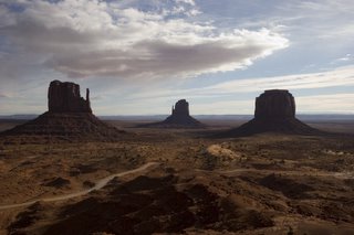
We reach Monument Valley, pay our $10 entrance fee again, that gets me sort of bummed. However, it is still a bargain for the sights you get to see. We sign in at the visitor's centre, supposedly you have to do this before you leave and sign in again after you return. I see that for this year there were only 30 or so entries in the book. We head out, on top was windy and cold, hats, gloves, winter coats are definitely required. Once we get going though, we warm up quite nicely, aided by the fact that the valley floor is well sheltered from the prevailing westerly wind.
At the outset, a sign tells you what not to do and what to look out for. Don't stray from the trail and do look out for venemous reptiles and insects. I presume they mean snakes and scorpions, but I'm sure these critters won't be out in the cold weather we are facing. The trail itself is moderate to easy and well marked, so getting lost is definitely difficult. The 5 km trail leads around one of the main buttes, called 'West Mitten Butte'. Since nothing but the birds and the wind, as well as the occasional click of the camera shutter may be heard, it makes this extra special to be there next to these giants who seem to take on human qualities with their shapes and sizes. The views again are spectacular and it seems like the trail's end arrives sooner than anticipated. We meet no one. I sign out and we leave Monument Valley for other visitors to enjoy.
Having still most of the day ahead of us, we decide to follow Hwy 163 north into Utah, then go east on 162 into Colorado and then take 160 back again to Kayenta for a circle tour. Just north of the Arizona border, in Utah, the views are quite spectacular, especially that of Monument Pass looking back towards Arizona.
However, the rest of the scenery in Utah is awesome as well. One can only wonder what shapes of nature created the landscape, but one thing's for sure: the area was a cauldron at one time. When we cross the San Juan River, we come to a place called Mexican Hat and I wonder where did they get that name. Well, it isn't very long before I come around a bend in the road and see this. Puzzle solved. I find a spot in sight of the Mexican Hat, we eat our lunch there, hmm, cucumber sandwiches. After lunch, I decide I must get a shot of the Hat, so I walk across the desert for half a kilometre in order to clear some hydro lines. Take the shot, then walk back again. We drive off, only to clear the next hill and see a driveway right up to the flaming rock. Let me tell you, folks, it doesn't pay to be brainless. On we drive, more spectacular Utahian (sp?) scenery. We try to make it into the Valley of the Gods, but the smallest of creeks flows across the mud access road and I chicken out. Stopped by water. In the desert. Hoodathunk. The terrain gets even wilder with red colors, striations going every which way, then levels off somewhat as we head for the Colorado border. There, we 'hang' a right onto Hwy 160, and proceed on to the Four Corners.
Four Corners is the only place in the US where 4 states meet. At the exact spot is a monument placed by surveyors. The place is wholly contained in Indian Country: The Ute Nation in Colorado, the Navajo in Arizona, New Mexico and Utah. You pay $ 3.00 entrance fee to get near the place and for that you acquire the privilige of visiting hundreds of stalls selling jewelry, blankets and the like.Sort of like Costco, only out of doors. We instead have some Navajo Fry Bread, which tasted yummy, but don't ask me what was in it, flour I presume.
Next of course comes the customary and obligatory photographs. And, by the way, who sez a woman can't be in one place at the same time? I've got the pictures to prove differently: Anne equally divided in four states. I wonder which Sheriff would have to 'bring her in' if they hear the profanities she offers while I take her picture.
By the way, I placed my logger directly on the Monument, and, according to the way I see it, it is in the wrong spot by at least a couple of metres. Pity the poor surveyors who a hundred or more years ago had to run line to get to this point, far away from home and only marginally closer to the nearest saloon.
We continue our way, now westbound, to Kayenta. Fairly close to Kayenta, I stop for yet another exposed volcano core (there are actually quite a few in this area). Church Rock, it is called. Appropriately enough, it is Sunday.
We reach Kayenta and have to settle for Burger King, since every other restaurant except McDonald's has closed for the evening. Hoodathunk.
Today's KML file is here
Sedona, AZ to Kayenta, AZ
Day and night: that's the difference between Sedona, Arizona and Kayenta, Arizona. While Sedona is home to the rich and famous, latte consuming crowd, busy with many expensive shops and restaurants, Kayenta is on the Navajo Nation, very spread out, with few stores and even fewer restaurants. Nonetheless, the beauty that can be found near Kayenta, is, in the writer's eyes, second to none. But more about that later.
To get to Kayenta, you find your way back northbound on I-17, then at Flagstaff I-40 for a few short kilometres, exit at Hwy 89, up to 160 to Kayenta, about 250 km of easy driving. Except for one incident when I was going up a grade at legal 120 km/h and a truck pulled out in front of me, in order to pass another, even slower truck, which forced me to slam on the brakes. Should've known: the truck that pulled out was from la belle province.... Even this far from home we have no problem being prejudiced.
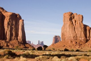
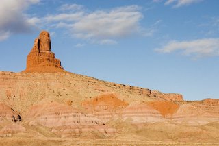
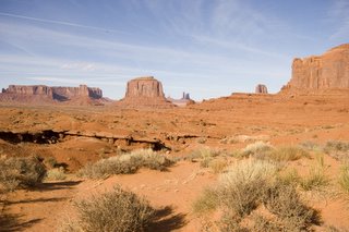
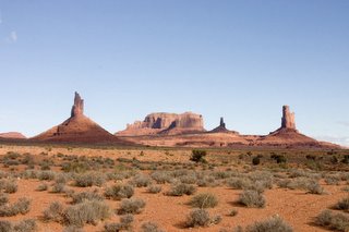
We arrrived in Kayenta around 1:00 in the afternoon, and, after checking out the town (which took all of 2 minutes), we decided to head on up to Monument Valley. Now most of you, I presume, have watched TV at some point in your life. In particular western movies, the shoot-em-up-look-very-serious-die-in-the-end kind. Well, quite a few were made in or around Monument Valley, solely because of its dramatic, err, umm, dare I say it, monumental landscape. (Also, quite a few character actors were available in the area, at reasonable rip-off prices) And by gosh, golly gee whiz, they're right, it is a truly spectacular sight, it should be included in the wonders of the world. This only made the whole trip worth it. Giant buttes (pronounce: bjoots) rise up to 300 m high from the desolate valley floor below. It all has to do with plate tectonics within the last 30 odd million years or so, the details of which I will spare you.
We first perused the gift shop, since you never know what you might find there. Alas, no luck, very expensive. On the other hand, that made our earlier purchases look good. We noticed there was a walking trail, so we decided to reserve that for the next day, Sunday. Today, we'd drive the 25 km, so called "Valley Drive". How do they come up with these names? It's actually a dirt road with many sections suffering from either washboarding or rocks protruding out from the surface, not to mention dust flying everywhere but away from you. However, it's only a rental car, so who cares if you have to plug the oil pan with the root of a sage brush yanked from the desert floor. Fortunately, it didn't come that far, but I was passed by quite a few people in Hummers and other SUV's who can now brag to their friends at home they did Monument Valley in 10 minutes. Do I sound bitter, just because I had to eat their dust?
I hate it when I get carried away like that. The drive. It should be about the drive. Which is breathtaking, stunning, exceptionally beautiful and also very nice. There are waypoints where you can stop for scenic lookouts. When all traffic noise dies down, the solitude that creeps over you when you look at these strange rock formations that should not be, rolls up your spine, grabs you by the neck and makes you think there is a ... Looking at these 'things', it isn't hard to imagine that the natives came to believe their Gods were in this valley. It is very easy to see faces, shapes, human form in the rocks that rise up to the heavens. But have a look for yourself, even though the pictures cannot, by any means, convey the depth and magnitude of the landscape.
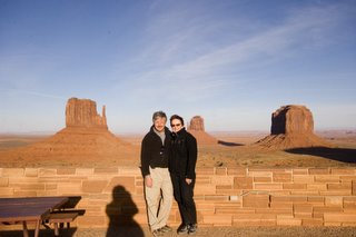
After the drive finished, I wanted to wait until closer to sunset, so the buttes shadows would be longer, giving a more dramatic effect. So we had some tea in the visitor centre restaurant. Wouldn't you know it though, this time of year, the sun from the visitor's centre is right in your back (Notice the shadow from the helpful amateur photographer in the pic of Anne and I). So that took care of that. We headed back to Kayenta.
Now what's there to do in Kayenta on a Saturday nite, you ask. And why shouldn't you ask. Well, since we'd been on the road for over two weeks, our supplies of fresh undies was getting precariously low. In fact, the prospect of recycling crept ever nearer. In order to head that off, we drove to the local laundromat, which is a truly happening place, so packed with people and noise, in fact, that if you closed your eyes you could imagine yourself being on the dance floor in some swanky Ritz hotel. Open your eyes though, and it is still only a laundromat in Kayenta. There we stood, like two klutzes, totally lost, surrounded by these peoples who were all experts in running these machines. Fortunately, we were aided by a few very friendly people, in particular one, I would say, 13 to 14 year old girl, who kept on her eye on us, and was ever ready to give advice on how to properly start the dryer for instance. Otherwise, we'd still be there. Either that, or we'd be kicked out long ago, because of the laundromat flooding.
With bags full of fresh smelling laundry we made our way to Hampton Inn, one of the only restaurants in town, for a very good meal, indeed.
Tomorrow, Kayenta again (Spanish translation: 'Quando Calienta el sol'....)
Today's KML file here
Friday, February 17, 2006
Sedona, AZ
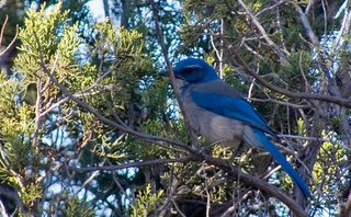
First the bad news: there will be no logging for the next two days. Reason being: we are staying put in Sedona and only use the car for errands such as getting groceries, booze and getting to trail heads. We didn't even use the car at all yesterday as the trail we selected to walk started right in our backyard. Or so I thought, by looking at the map. Actually, it started about 1.5 km away from our back yard at the end of Jordan Avenue, the road on which our motel is situated. So that added to the overall length of the trail, which was to be almost 4 km one way. Brilliant sunshine greeted us as we headed out, jovial mood, backpack full of supplies, water, alcohol, jalapeno chips, all good sustenance. Alas, I lied about the chips and alcohol. Almost immediately I spotted a blue bird (appropriately named) in a tree and fired of a couple of shots with my Rebel. We really haven't seen much wildlife in the way of birds or mammals, I suppose the lack of moisture makes it very difficult for it to survive.
Speaking of moisture, nearby Prescott broke a record today with 121 days without rain ( never mind snow). Although today was cloudy, and it actually rained in Phoenix, there was no rain in Sedona. It is very rare indeed to see free standing water here. That's why, when it's cold, it's a "dry cold". I don't know how many times I heard that phrase before and scoffed at it, now I'm afraid I am forced to pick crow from the menu.
I believe the explanation for dry cold goes something like this: Since there is little moisture in the air, not much of it can deposit itself on your skin. Therefore, only a little heat is extracted from your body in order to accomplish evaporation of this moisture.
The explanation for dry heat is this: since the moisture content of the air (relative humidity) is low, any perspiration a person produces readily evaporates, making one feel cooler.
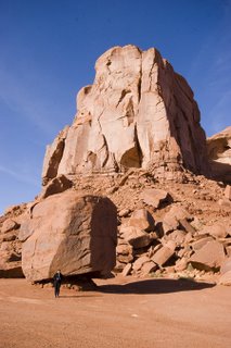
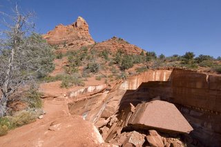
But once again I digress. The trail was relatively rough, with quite a few steep inclines. After an hour, right at the top of the trail, we met some people who told us to make a loop out of it by joining up with another trail. Easily convinced, I fell into the trap. This trail took another 1.5 hours to complete. At the very end of it, almost adjoining the first suburban houses of Sedona, we stumbled upon this truly massive sink hole, measuring roughly 100 m by 100m and 30m deep. You can only wonder what forces of nature were at work to create this enormity. The most fascinating feature though was the fact that all walls were undermined and on the north side a ginormous rock, the size of a small apartment building had broken off from the underside of the upper ridge of the cave. This must have happened sometime between yesterday morning and 10,000 years ago. The fractures lines are so clear, that if one had enough strength and one happened to have a (non leaking) bottle of Krazy Glue in one's pocket, one could pick up the rock and glue it back into place. For perspective, I asked Anne to stand on the last remaining piece of the cave bridge, which she reluctantly did, although cries of "Hurry up" and "Am I being paid for this?" were clearly audible across the canyon floor. I told here to not to worry, that the bridge would likely stand until the next earthquake, but somehow she seemed to attach very little value to my well analyzed statement. Note that if you doubleclick the boulder picture, you might just spot her with hands in the air, as if grasping for straws.
Having safely cleared the sinkhole, we were at the end of the trail, at the outskirts of Sedona. However, we were nowhere near our motel. So now we had to complete the loop by walking back to the motel along a 4 lane highway, with cars zooming by at the rate of 100 per minute. Needless to say a fair amount of grumbling was being done, as we had already walked for 3 hours in the hot blazing sun. Some phrases being carefully formulated and finally uttered were "dyin' of skin cancer", "suckin' up gasoline fumes" and wanting equal time on my blog. I sheepishly decided to avoid a confrontation , bite my tongue, which I did until it bled profusely.
After an hour, we reached the first latte house of Sedona, where I was instructed to order coffee and something good to eat. I desperately searched for jalapeno and cheddar chips, but ultimately only came up with macadamia (sp?) cookies.
We gathered the last strength our legs could muster and walked the last half kilometre home, Anne noticing by the way that this severe senior citizen couple walking ahead of us seemed to go faster than we did.
Finally, we reached home and we had showers and rested. Anne prepared a turkey lasagna we bought at Safeway earlier and it was grand.
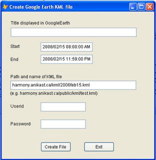
Technology wise, I worked on creating a KML creation and upload utility (program), which is now finished. It uses the shareware version of West Wind wwclient classes to perform the FTP action up to my own server. So now, at the end of the day, all I need to do is supply a few parameters and I'm done.
Now the good news: it appears we will live to see another day...